Kyzyl-Kiya Airport (Kyzyl-Kiya Airport)
The Kyzyl-Kiya Airport (Kyrgyz: Кызыл-Кыя аэропорту, Russian: Кызыл-Кийский аэропорт) serves Kyzyl-Kiya and Pulgon, towns in Kadamjay District of Batken Province (oblast), Kyrgyzstan. The Russian IATA code for Kyzyl-Kiya Airport is КЫК.
Kyzyl-Kiya Airport started operations in the 1930s as a landing strip near the mining town. The current runway and terminal were built in the 1970s. It is a regional class 3C airport. The runway has a weight limit of 22 tonnes, and has no instrument landing facilities and operates only during daylight hours.
Although Kyzyl-Kiya Airport is near the border with Uzbekistan, it has no customs and border control checks and serves only flights within Kyrgyzstan. Until 2002, Kyzyl-Kiya had year-round links with Bishkek, Osh and Cholpon-Ata.
Map - Kyzyl-Kiya Airport (Kyzyl-Kiya Airport)
Map
Country - Kyrgyzstan
 |
 |
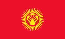
| Flag of Kyrgyzstan | |
Ethnic Kyrgyz make up the majority of the country's 6.6 million people, followed by significant minorities of Uzbeks and Russians. The Kyrgyz language is closely related to other Turkic languages.
Currency / Language
| ISO | Currency | Symbol | Significant figures |
|---|---|---|---|
| KGS | Kyrgyzstani som | Ñ | 2 |
| ISO | Language |
|---|---|
| KY | Kirghiz language |
| RU | Russian language |
| UZ | Uzbek language |


